|
_____________________________________________________________________________
Basic
Reporting Procedures
Please remember to identify yourself as a
trained spotter and give your ID number.
Always use the "Four Ws" when
reporting:
- What
- Where
- When
- What it's doing
- Report any strong winds (50 mph or
greater), or any wind that produces damage.
- Report any hail. Refer to hail size in comparison to coin
(dime, nickel, penny,
quarter). DO NOT mention "marble" size
hail.
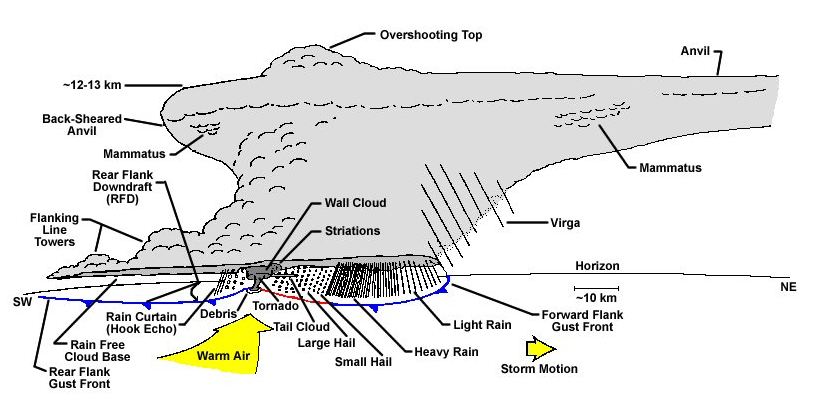
- Report funnel
clouds, wall clouds or tornadoes. Remember, rotation and
persistence
are the keys!!
- Tornados are
funnel clouds that have touched down. Look for debris at base
- Report damage
(even well after the event).
- Report flooding.
Who
To Notify (800
number to be used by certified SkyWarn Spotters)
Have
the following information ready:
-
Skywarn
Spotter ID number
-
Location:
Lat /Long or GPS if known
-
Type
of severe weather
-
Wind
Speed if known
-
Direction
Severe weather is moving
If
spotter observation is after the hazard has past, do not
call the Hot-line but follow up with NOAA / NWS on-line
Spotter
report form
(On-Line spotter report may be
used by general public)
On-Line
_____________________________________________________________________
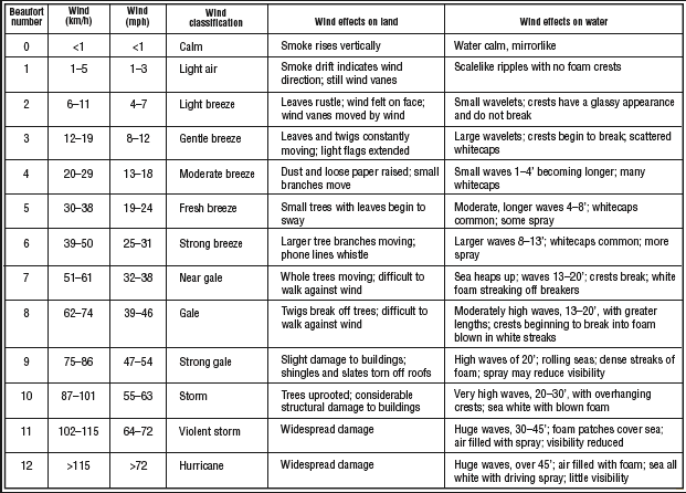
Wind
Scale
Wind
Speed Estimation
Hurricane
Scale

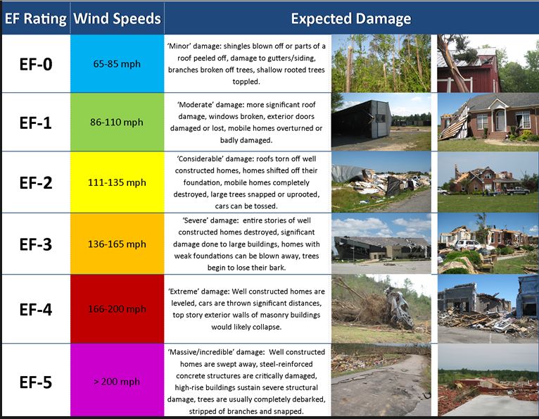
Tornado
Scale
_____________________________________________________________________
Spotter
Field Guides
Do not risk your life or the live of another
to obtain weather information or data.
For
additional information on SkywarnTM, please write or
phone the NWS, Monday through Friday 800 A.M. to 400 P.M.
National Weather
Service
Robert
Molleda (Warning Coordination Meteorologist)
11691 SW 17th Street
Miami, FL 33165
305-229-4520
|


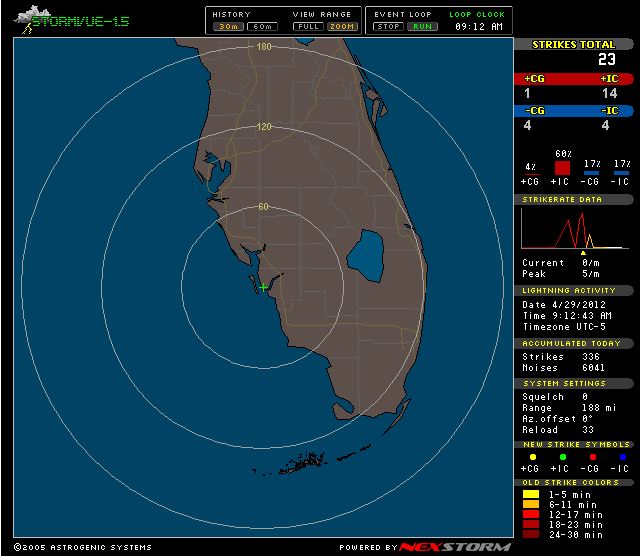
Lightning Radar
Interactive Radar

US Weather Maps


Live Local NOAA
All Hazards Radio
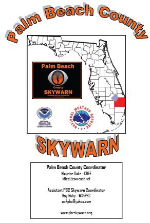
Contact PBC Skywarn
Coordinator:
Maurice Dake
K9EE
561-374-4249
mldake@comcast.net Assistant
Coordinator:
Ray Ruby WX4PBC
561-261-1224
wx4pbc@yahoo.com NWS
Skywarn WFO Miami
Robert
Molleda
305-229-4520 robert.molleda@noaa.gov Skywarn
Repeater:
146.670 -
600 ( PL-
110.9) 
PBC
SKYWARN NEWS
Visit
our
Spotter Information
page for Spotter reporting criteria, wind
speed guides and cloud formation chart
______________________________________
Visit
our Spotter
Download
page for Pdf files useful for Spotter
activities
______________________________________
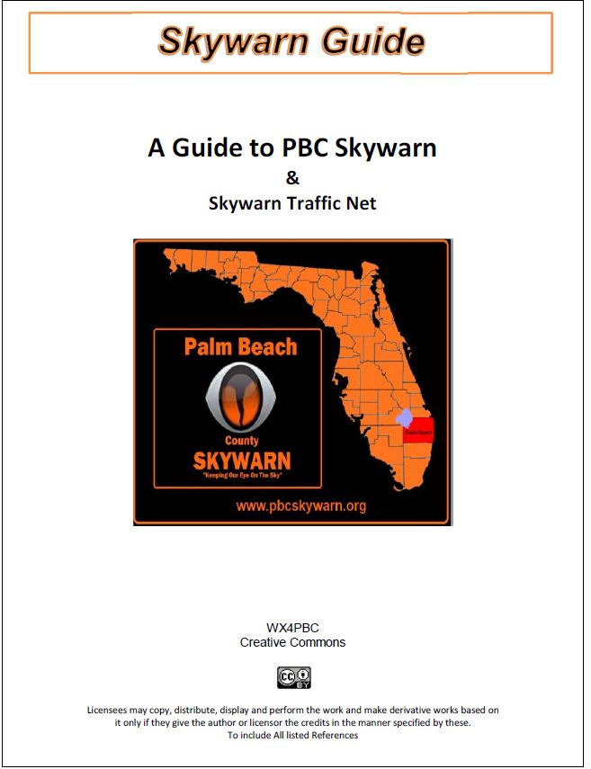
Attention Skywarn Members
New
PBC
Skywarn Guide
New
PBC DART Smart phone App Palm
Beach County Disaster Awareness
and Recovery Tool
Updated
app 5/2013 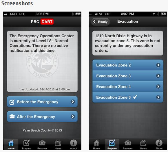
For
more information click picture
Application
can be found at Google MarketPlace & iTune Store
|